The Pacific Northwest Wildfire Conference and Exhibition held from April 3 to 4, 2023, in Seattle, Washington, attracted 48 exhibitors and more than 385 aerial firefighting, local government, federal government, nonprofit, and academic attendees from around the world.

Hosted by Washington State Commissioner of Public Lands Hilary Franz and the Washington Department of Natural Resources, the event was the first of its kind in the Pacific Northwest region.
“After attending the Aerial Firefighting North America 2022 conference in San Diego, I knew we had to host something similar here in the Pacific Northwest,” Franz told Vertical. “I wanted to bring the experience, expertise, and understanding from the caliber of presenters in San Diego to Seattle to help galvanize our northwest states to be a united voice for the resources we need in the air and on the ground to fight fires, build landscape resilience, and work with our communities on preparedness.”
The event was the 23rd edition of Tangent Link’s global aerial firefighting series and focused on what Franz described as the three pillars of wildland fire issues: response, landscape restoration, and community preparedness and resilience.
Presenters at the conference ranged from academics, forest policymakers, and federal agencies to nonprofits, wildland firefighting companies and agencies, and aircraft operators and pilots.
Moderated by local retired veteran aviation television broadcast journalist Glenn Farley, the event began with a welcome by Franz and keynote address by former Oregon Governor Kate Brown. Oregon experienced catastrophic losses in 2020 and the experience sparked Franz and Brown to unite the northwest states in making unified asks to the federal government, given individual state needs were not being met at levels needed to manage growing fire seasons and losses, Franz told Vertical.
Subject matter experts covered a variety of topics throughout each day, including wildfire leadership, scaling for aerial support growth, landscape resilience, wildfire mitigation opportunities, redefining nighttime aerial firefighting, accelerating wildlife resources, innovations in fire retardants, the use of unmanned aircraft systems (UAS) to fight fires, and the latest technology in wildfire detection and suppression.
Interagency cooperation examples were plentiful in the presentations to spark further partnerships.
David Zadar, a member of the International Association of Fire Chiefs, and Major Christopher Moskoff, Army Aviation Support Facility Commander and Operations Officer for 2-135th Aviation Regiment of the Colorado Army National Guard, made an enlightening presentation on how the state tapped and trained its national guard to help fight fires.

“The perception of our national guard is high with the public, but not so much with fire managers,” Zadar said to a packed room. “We realized there were opportunities to make our relationships more like a contract. We wanted to increase effectiveness by reaching out and building relationships with the guard and working with them to help them do well.”
Brian Fennessy, fire chief for Orange County Fire Authority in California, shared another story of successful collaboration, this time between counties and their power companies. San Diego Gas and Electric, which was purchasing an Erickson Air Crane to build towers, worked with Cal Fire to use the aircraft for firefighting in the summers.
This same model was then taken to Los Angeles County and its surrounding counties by partnering with Southern California Edison. What started as a 180 contract with Southern California Edison to use aircraft on fires has since turned into a 365/24/7 operation with four aircraft and a mobile retardant base available in the 15 Southern California counties where Southern California Edison provides service.
Similarly, Dan Reese, president for the International Wildfire Consulting Group, shared data-backed research showing the value of aerial firefighting in shortening fire growth and preserving land and property. Using this research, he demonstrated how a fleet of federally-funded air tankers made available to all states to protect non-federal land and provided free of charge for the first four hours of use would save tax dollars down the road.
These and several more partnership opportunities were balanced with discussions of the barriers to more effective firefighting. In addition to contract language and differentiating regulatory oversight, labor was a big obstacle theme. Without skilled firefighters, ground crews, pilots, and mechanics who are well paid so they stay, aerial firefighting cannot expand.
“The target is running away from us,” said Chris Neimann, general manager of Aero-Flite Inc., about trying to keep a well-paid steady, trained, and retained staff available for fires.
New technology for firefighting
Discussions during the conference often turned to new technology — what was recently released, how it can be integrated into operations, how agencies can approve it faster for wildland firefighting use, and ways it will help battle ever increasing blazes and year-long seasons. Several of these innovative advancements were on display at the conference.
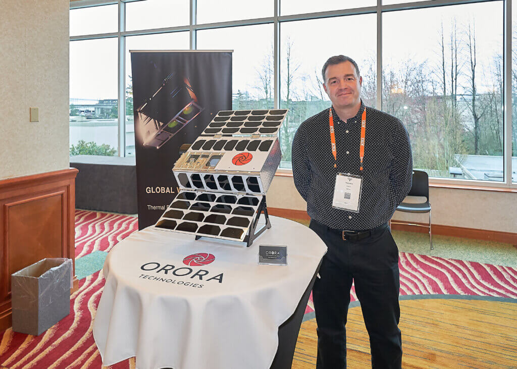
Orora Technologies satellite services
Smaller than a carryon suitcase, Orora Technologies’ thermal imaging satellites circle the globe detecting hot spots as small as a single tree and delivering that mid-wave infrared intelligence within three minutes of overpass.
“Presenters [at the conference] talked about the need for more accurate detection information and situational awareness information for fire, and that is what we provide on a very broad scale across the entire country,” said Tyler Smith of Orora Technologies.
The first satellite launched in 2022, providing one overpass a day. The second satellite will launch in June 2023, increasing the daily passes to eight. The company is fully funded to launch eight more in 2024, increasing passes to 48 per day. Day or night, satellites are looking for wildfire hotspots during each pass, sending an alert to subscribed customers within three minutes of the pass, helping agencies perform rapid response.
Currently the company’s wildfire solution is being used by companies and government agencies alike around the globe.
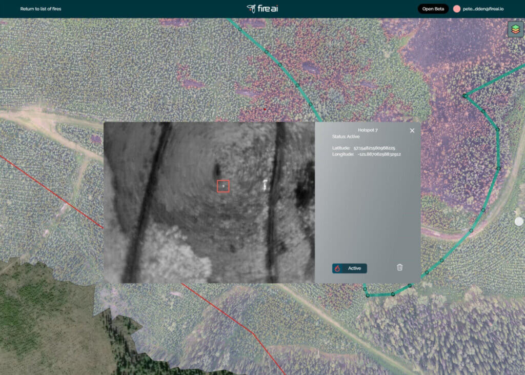
Fire AI app
Just as GPS and satellite imagery did in the 1990s, data gathered from drones can significantly impact how fires are managed. Yet the barrier is how that imagery is used to create easy-to-read maps with exact locations of hotspots.
Fire AI was developed by Canadian wildland firefighters who founded a drone company that gathered data for wildfire management. They soon realized, however, there was just as urgent a need for a data processing solution that helps wildfire managers quickly gain situational awareness and make valuable decisions from RGB and infrared imagery captured by aircraft.
Fire AI was designed to be a funnel for all the data and, with the help of artificial intelligence, to create an accurate map with hotspot locations. Prior to Fire AI, a geographic information technician was required to bring data together to create a hotspot map. Fire AI does this through its free open-source platform accessible on its website fireai.io. Maps include orthomosaic correction for image distortion, fire perimeter outlines, hotspots, aircraft flight path, and more.
“You simply load your visual and infrared data from your drone, helicopter, or airplane overflight into Fire AI and in a few clicks, you have a beautiful, informative map for your fire suppression operations,” Fire AI director of business development Peter Carscadden told Vertical.

Intellic Technologies FS3D
Intellic Technologies recently released FS3D, the first commercial wildland fire training simulation product that integrates virtual reality and mixed reality (VR/MR) to train and maintain proficiency for aerial supervisors, airtanker pilots, helicopter pilots, and ground crews simultaneously in the same simulation.
The basic premise is to create realistic simulations of full fire scenarios allowing all participants in the fire suppression team to practice procedures, communications, and operations down to water drops, giving these professionals valuable practice without the risk and expense of actual operations.
The technology utilizes voiceover IP technology in an aircraft radio simulator and Lockheed Martin’s Prepar3D advanced aerial simulation platform to create a realistic communications experience for participants. Users wear virtual reality goggles and manipulate physical control units while in the simulation.
“We can recreate any former fire or make a completely new one based on anticipated scenarios anywhere in the world for whole aerial firefighting teams to practice operations and test firefighting tactics,” Intellic Technologies aviation sales lead Joel Lane told Vertical. “Each participant can be in another room or across the world, practicing and operating together in the simulation.”
The system includes accurate virtual cockpits and flight dynamics for every aircraft fighting wildfires today, which can be modified to meet agency or company aircraft specifics.
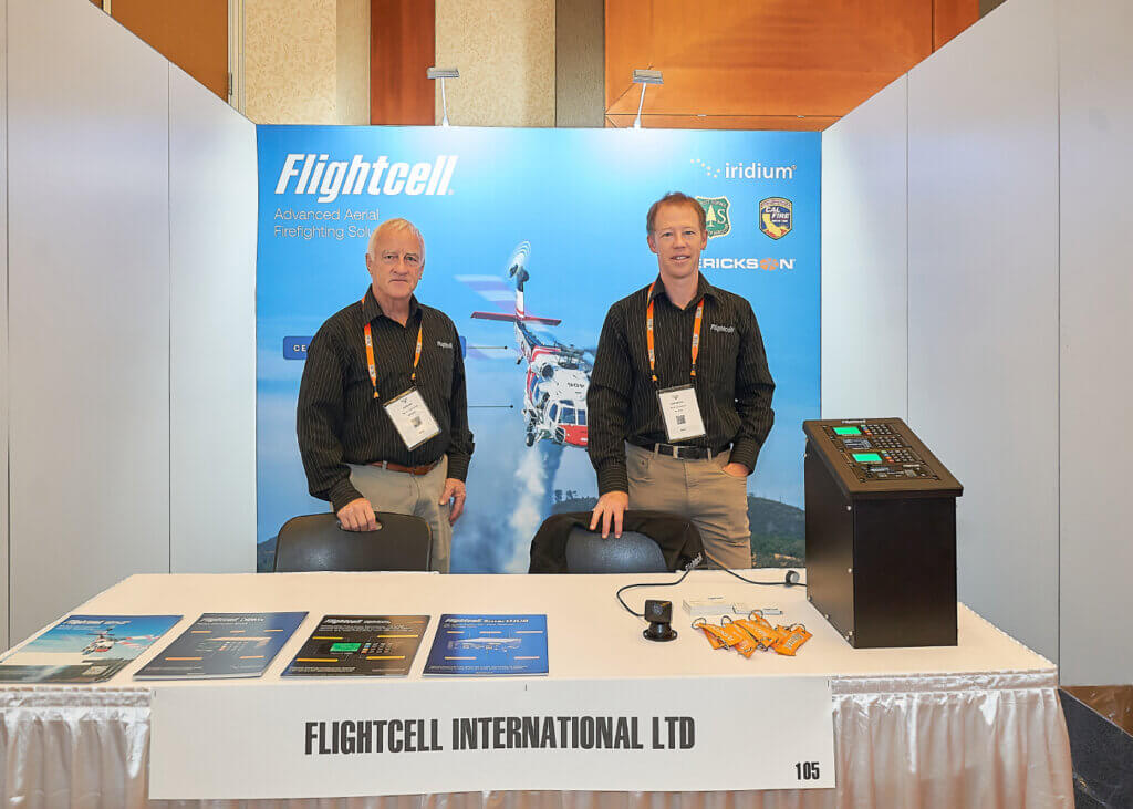
Flightcell DZMx
Flightcell’s new DZMx is the first of its kind Iridium Certus 100 satcom and cellular voice, data, and tracking system for light fixed-wing and rotorcraft operators. Connecting to satellite in remote areas and cellular towers when in range, the system provides cellular and satellite mid-band data and voice services with uplink speeds up to 88kbps.
“This is really an ideal solution for aerial firefighting as it offers a variety of communications options regardless of how remote the area, as well as the ability to track flight data,” James Glasgow, Flightcell production and technical services manager, told Vertical.
The DZMx also offers a variety of connectivity options including ethernet, USB, WiFi, and Bluetooth, and allows for the connection of a smart phone for hands free calling and audio streaming. The device is also unlocked, allowing operators to choose a preferred airtime and tracking provider.
The solution is fully compliant, allowing operators to meet U.S., Canadian and Australian automated flight forwarding (AFF) requirements. It has a built-in ATU and multiple onboard inputs and tank/bucket sensors, providing aircraft performance data in addition to tracking engine and in-flight status, location and volume of water and additive added and released, exact flight path data, and more.